Photos of Around Alice Springs, Central Australia


Around Alice Springs, Central Australia
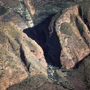
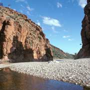
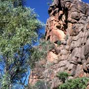
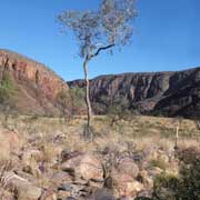
The country around Alice Springs, in the centre of Australia, is a nature wonderland, attracting visitors from all over the world. It has spectacular gorges, like Simpson's Gap, where Roe Creek has carved out a narrow gorge with towering cliffs through Rungutjirba Range; 22 kilometres further on is Standley Chasm with its smooth vertical walls, owned and managed by the Iwupataka Aboriginal community at the turn-off, where an entry permit needs to be bought.
you may then send it as a postcard if you wish.
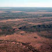
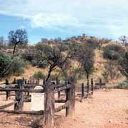
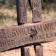
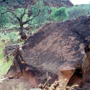
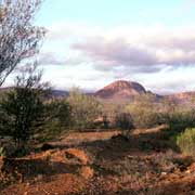
Heading east from Alice Springs, about 40 kilometres along the road to Ross River, is Corroboree Rock, a striking dolomite hill. There is a small cave here where in the past Aboriginal people stored their sacred objects. Trephina Gorge Nature Park, about 70 kilometres east of Alice, offers nice walks and good swimming at John Hayes Rockhole. N'Dhala Gorge, further on, features hundreds of ancient rock carvings. Further on, about 115 kilometres from Alice Springs, is Arltunga Historical Reserve, a ghost town dating from its gold mining days from 1887 to 1913.
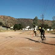
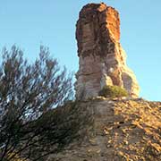
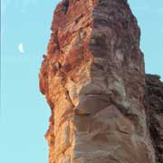
About 90 kilometres south east of Alice Springs, along a dirt road, is the Aboriginal community of Ltyentye Apurte, formerly a Catholic mission and now the centre of the Santa Teresa Aboriginal Lands Trust. Another road leads 120 kilometres south from Alice to Maryvale station, from where a rough track leads over large sand dunes to Chambers Pillar (known to the Aborigines as Itirkawara, the Gecko Ancestor), that stands like a sentinel 50 metres above the low sand dunes on the western edge of the Simpson Desert landscape. It is a great trip, but strictly four-wheel drive!
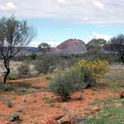
Following the Larapinta Drive west from Alice Springs, the road forks after 47 kilometres; whereas the left turn goes towards Hermannsburg, the right turn is named Namatjira Drive from here. It is named after Albert Namatjira, a Western Arrarnta man who was born at Hermannsburg Mission in 1902 and who was the first Aboriginal painter who used the "European" way of painting his country. Having been given watercolours as a young man, he immortalised the beauty of his country in countless paintings. And it is precisely the kind of landscape that inspired him that can be seen along the road that now bears his name.
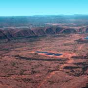
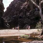
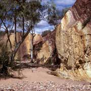
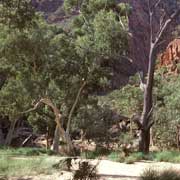
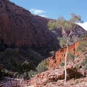
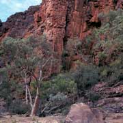
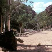
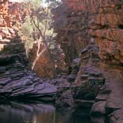
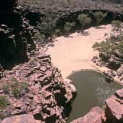
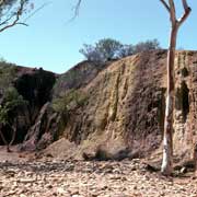
The road runs along the southern boundary of the West MacDonnell National Park and features lush parkland and water holes, like Ellery Creek Big Hole Nature Park and Serpentine Gorge, with clear cool water and plenty of shade. Further west, beneath Mount Giles (1300 metres) the Ochre Pits, where from time immemorial Aboriginal people obtained red and yellow ochres to be used in their ceremonies, can be visited. Bands of ochre can be clearly seen in the rocks. Further on, about 130 kilometres from Alice Springs, is impressive Ormiston Gorge, where a great walk can be made to Ormiston Pound and back through the gorge. Experienced bushwalkers could hike to Mount Giles, with fantastic views from there.
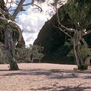
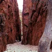
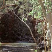
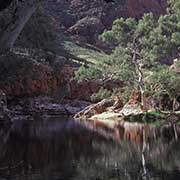
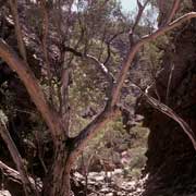
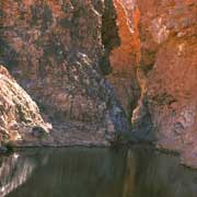
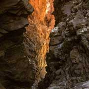
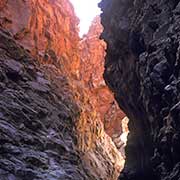
Not far from there is Glen Helen Gorge where the Finke River (known locally as "Larapinta" or serpent) flows into a deep, permanent waterhole. There are interesting rock formations behind the gorge and there is a Resort here, complete with motel, restaurant, camping facilities and even helicopter flights. And about 20 kilometres further on, along a dirt road, is Redbank Gorge, with a permanent water hole a 20 minute walk up the rocky creek bed. It is a very narrow gorge with cold clear waters among towering red cliffs.