Photos of the Old Mining towns, west of Atherton Tablelands, Australia


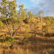
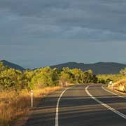
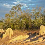
The Old Mining towns, west of the Atherton Tablelands
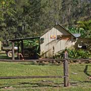
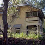
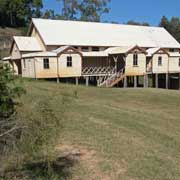
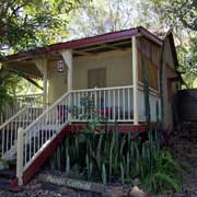
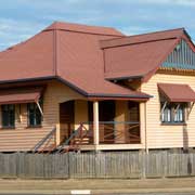
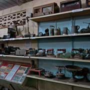
About 25 kilometres east from the tin mining town of Herberton, on an unsurfaced road, is the small town of Irvinebank, established in 1882 under the name of Gibbs Camp at another tin mining site. In 1884 the town dam was built and the Loudon Mill started operation. The town's name was changed to Irvinebank by John Moffat, Queensland's greatest mining entrepreneur: apparently the place reminded him of the place he was born, in Scotland. Nowadays the old tin mining town seems in a time warp, looking pretty much as it was in its heyday; around 310 people live here now. There are still many old tin houses; the building materials were brought in by mules and packhorses in those days. John Moffat's house was in its day the first high-set building in Queensland. The road continues until it joins the Burke Developmental Road in Petford.
you may then send it as a postcard if you wish.

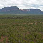
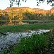
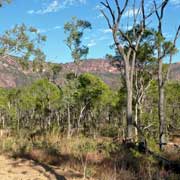

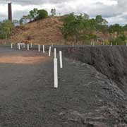
Mount Mulligan, some 50 kilometres north of the settlement of Dimbulah - on the Burke Developmental Road from Mareeba to Chillagoe - is in the Carbine region at the foot of Ngarrabullgan, a very important sacred mountain to the local Djungan Aboriginal peoples. It is a tabletop mountain, 18 by 6.5 kilometres with at the top the two oldest-known Aboriginal sites in Queensland: Nonda Rock and Ngarrabullgan Cave. Aboriginal cultural deposits have been dated back to more than 40,000 years. The whites named it Mount Mulligan after James Venture Mulligan who explored and named the area in 1874. A coal mining town was established here, but on 19 September 1921 an underground coal dust explosion killed 75 miners, almost the whole adult male population of the town. The mine closed in 1957 and it is now a ghost town, with maybe 56 people living there.
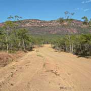
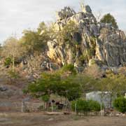
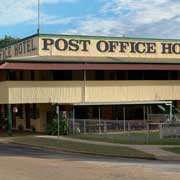
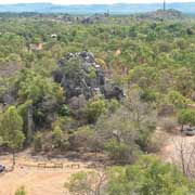
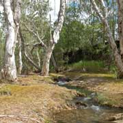
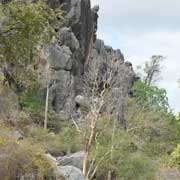
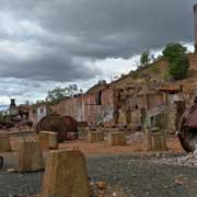
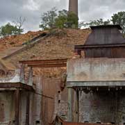
Chillagoe, about 140 kilometres from Mareeba along the Burke Developmental Road, was once a thriving mining town for a range of minerals, It was apparently named by William Atherton (who gave his name to the Tablelands, just to the east) in 1888; the name is taken from the refrain of a sea shanty: "Hikey, Tikey, Psyche, Crikey, Chillagoe, Walabadorie". There were rich copper deposits in the area; a railway was completed in 1901 and the smelters built from materials that could be brought in. The Chillagoe Smelters to become operative by September 1901 and, until its closure in 1943, processed 1.25 million tons of ore, yielded 60,000 tons of copper, 50,000 tons of lead, 181 tons of silver and 5 tons of gold. Nowadays Chillagoe is a small town with maybe 300 inhabitants.
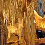
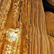
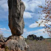
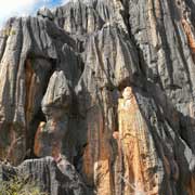
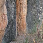
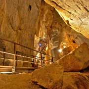
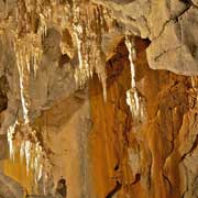
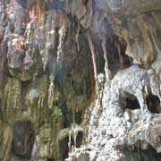
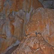
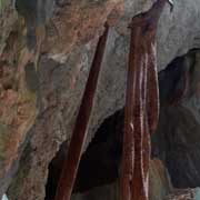
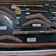
Just out of town is the Chillagoe-Mungana Caves National Park containing limestone caves with spectacular stalactite and stalagmite formations. There are between 600 and 1,000 caves in the Chillagoe-Mungana area; the Donna and Trezkin caves, 1.8 kilometres out of town, have electric lighting and can only be visited on a guided tour. Further on, 7 kilometres out of town, is the Arch Royal Cave, where the visitor is provided with battery-operated lamps to explore the vast cave on a guided tour. There are Aboriginal rock paintings in the area too; near Trezkin Cave, at the Balancing Rock, is the Wallumba art site with a small boardwalk to provide viewing access.