Photos from Albania


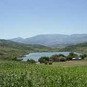
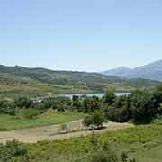
The Gjirokastra district, in southern Albania
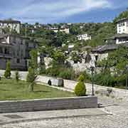
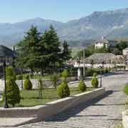
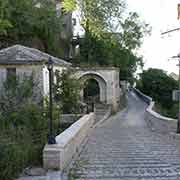
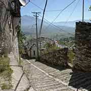
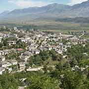
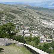
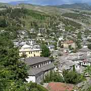
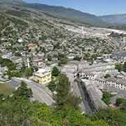
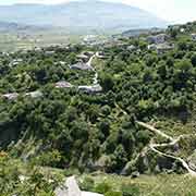
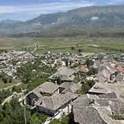
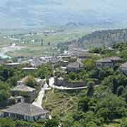
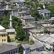
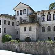
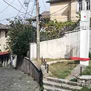
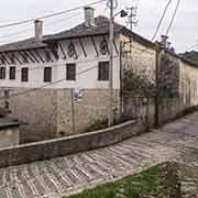
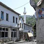
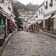
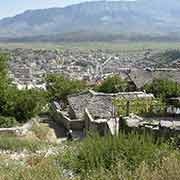
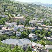
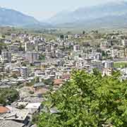
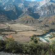
Gjirokastra (or Gjirokastër in a sentence with a preposition) is a city with a population of around 43,000. It is remarkable for its great natural beauty and its harmonious intercultural mix of Albanian, Byzantine and Ottoman heritage. An ancient city in the historical region of Epirus, it sits at 300 metres above sea level on the slopes of the Mali i Gjerë (“Wide Mountain”), overlooking the Drinos river in the south of Albania.
you may then send it as a postcard if you wish.

Gjirokastra was probably founded some time in the 12th Century CE during the Byzantine Empire, around a fortress on the hillside and known by its Greek name of Argyropolis (“Silver City”) or Argyrokastron (“Silver Castle”). In 1417 it became part of the Ottoman Empire. It remained so until it was captured in 1811 by the Albanian-born Ali Pasha of Tepelena, who carved out his semi-autonomous fiefdom in the southwestern Balkans. It subsequently became a centre of resistance to Turkish rule in the late 19th Century. The Assembly of Gjirokastra, a key event in the history of the Albanian liberation movement, was held there in 1880.
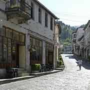
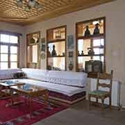
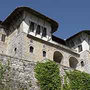
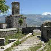
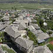
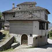
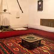
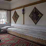
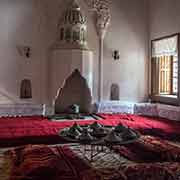
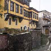
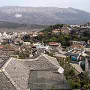
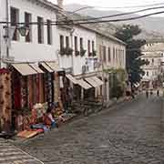
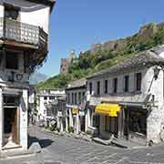
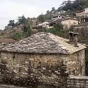
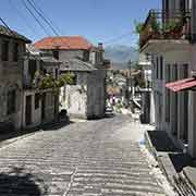
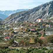
As the region has a substantial Greek minority, the city was claimed by Greece during the First Balkan War of 1912-1913. It was occupied several times by the Greek army but eventually returned to Albanian rule in 1919. When Albania was under Italian occupation during the Second World War, the Greek army occupied “Argyrokastron” again for six months. After capitulating to the Germans, they had to return it to Italian and later German control; it was back under Albanian control in 1944. During the communist years, the city was developed as an industrial and commercial centre. As it was the birthplace of the dictator Enver Hoxha (in 1908), the regime elevated it to the status of a “museum town”. Hoxha’s house (reconstructed, as the original house had burnt down in 1916) was converted into a museum, becoming a focal point of the dictator’s cult of personality. Many homes in Gjirokastra have a distinctive local style that has earned the city the nickname “Town of the Stones” because most old houses have roofs covered with stones. Unfortunately, many of its historic buildings have become dilapidated, a problem that is slowly being addressed. As tourism has become increasingly important, some houses are beautifully restored. An example is Hotel Kalami, with its carved wooden ceilings, stone fireplaces, and authentic furniture. Its old town is inscribed on the UNESCO World Heritage List as “a rare example of a well-preserved Ottoman town”.
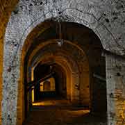
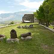
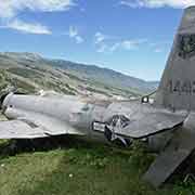
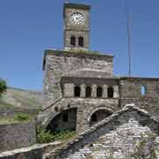
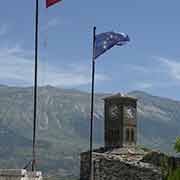
The Kalaja (Citadel) dominates the town and overlooks the strategically important route along the river valley. It has a military museum featuring captured artillery and memorabilia of the Communist resistance against German occupation. There is also a United States Air Force Lockheed T-33 reconnaissance plane that had lost its way and was forced down in December 1957. The citadel dates back to the 13th Century. Ali Pashë Tepelena and the Government of King Zog built additions during the 19th and 20th centuries. Today it possesses five towers and houses a clock tower, a church, water fountains, horse stables, and many more amenities. The northern part of the castle was eventually turned into a prison by Zog’s government and housed political prisoners during the communist regime. Nowadays, it is the site of the National Albanian Folk Festival held every four years.
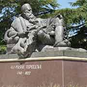
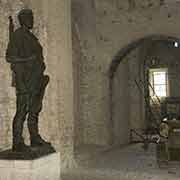
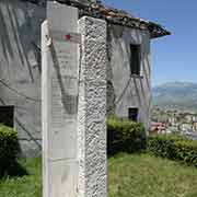
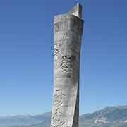
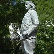
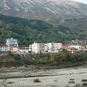
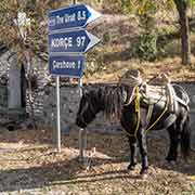
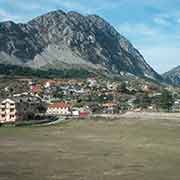
Thirty kilometres to the north of Gjirokastra is the small town of Tepelena (Tepelenë), on the left bank of the Vjosa (Vjosë) river, about three kilometres downstream from its union with the Drinos. It boasts a statue of Ali Pashë Tepelena, the “Lion of Yannina” (1741 - 24 January 1822), who was the Albanian ruler (pasha) of the western part of Rumelia, the Ottoman Empire’s European territory. His court was in Ioannina, now part of Greece. A semi-independent despot, he allied himself with whoever offered the most advantage at the time. He had a splendid court but was infamous for his cruelty to anyone crossing his path. In 1822 Ottoman agents assassinated him and sent his head to the Sultan. Despite his, at times, brutal rule, villagers paid their last respect to Ali: “Never was seen greater mourning than that of the warlike Epirotes” (the people from the region where Ali came from and lived). He was buried with full honours in Ioannina.
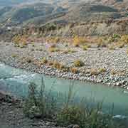
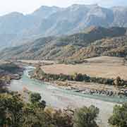
Just south of Tepelena, a road branches off, leading through the mountains of south Albania to Korça. It follows the Vjosa river to Përmet, a town of a little over 10,000; in the 19th Century, it was one of the leading centres of the Albanian National Awakening. The road continues to Çarçovë or Çarshovë, on the Greek border; the villages around here house Greek and Aromanian communities. The source of the Vjosa river is in Greece, just to the south and is named Aoös here, forming the border for a few kilometres. Close to here is the town of Leskovac, from where it is 84 kilometres to Korça.