Photos of New South Wales - The West, Australia


New South Wales - The West
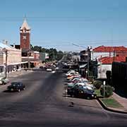
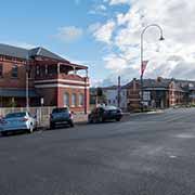
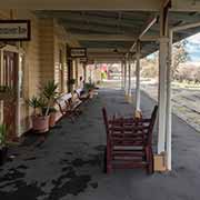
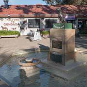
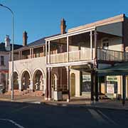
In the far west of New South Wales, near the border with South Australia, is the frontier mining town of Broken Hill, deep in the Outback. It is almost 900 kilometres to the northwest of Gundagai, considered a typical Australian country town.
you may then send it as a postcard if you wish.
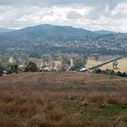
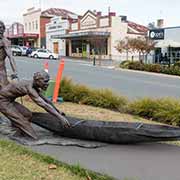
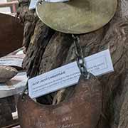

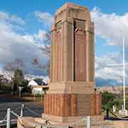


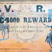


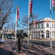


Gundagai is in the traditional lands of the Wiradjuri people and originally was situated on the floodplains of the Murrumbidgee River from 1835. The local Aboriginal people had warned the settlers it was prone to flooding, but they ignored this, despite several large floods hitting the township. There had been a flood in 1844 when Aboriginal people rescued several white settlers, but on 25 June 1852, the town was swept away, killing at least 78 people out of a population of 250. Local Wiradjuri men in bark canoes worked tirelessly to save as many white settlers as possible; two of them, Yarri and Jacky Jacky, saved up to 69. A sculpture of the “Heroes of Gundagai” was unveiled in 2017 on the main street of Gundagai. The brass breastplates given to them are now in the local Museum.
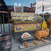
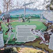
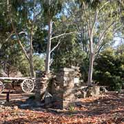
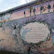
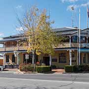
About seven kilometres north of Gundagai is the statue of the “Dog on the Tuckerbox”, relating to a humorous 19th-century poem; there is also the ruins of an inn of that period here. In the Yass valley, 85 kilometres northeast of Gundagai, is the town of Binalong, which was famously known as a hive of activity for notorious bushrangers. A mural in Pioneer Park depicts the story. In the Central West region of New South Wales, Cowra is a little over 100 kilometres further north, passing through the farming village of Boorowa.
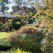
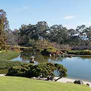
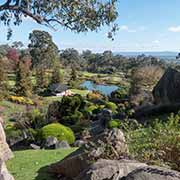
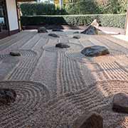
Cowra has a unique Japanese garden, opened in 1979 and established to recognise and develop the historic and ongoing relationship between Cowra Shire and the people of Japan. It goes back to the time during World War II when a Prisoner of War camp was near Cowra, with captured Japanese among its inmates. On 5 August 1944, at least 545 Japanese POWs attempted a mass breakout, but most were killed and buried in what became a specially created Japanese War Cemetery, the only one in Australia. In 1960 the Japanese Government decided to bring all their war dead from other parts of Australia to be re-buried here. They agreed to support the garden as a sign of thanks for the respectful treatment of their war dead.
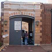
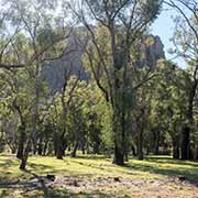
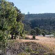
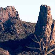
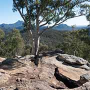
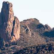
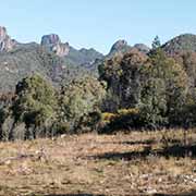
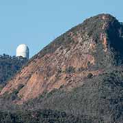
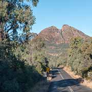
Dubbo, the largest town in the Orana region, is 212 kilometres further north, via the historic township of Canowindra and Molong. This region is also the traditional land of the Wiradjuri people. It features a statue of William Ferguson (1882-1950), an Aboriginal politician striving to better treatment of his people by the authorities. The town’s gaol is now a museum. After about 140 kilometres northeast from here, the town of Coonabarabran is reached, in the traditional lands of the Kamilaroi people. It is just to the east of the Warrumbungle mountain range, the remnants of a large, heavily eroded shield volcano active from 13 to 17 million years ago. It has jagged peaks, hilly bush and woodland forest, with hiking trails and great views. There is little or no light pollution; Warrumbungle National Park is certified as a Dark Sky Park. Siding Spring Astronomical Observatory is here, with the 3.9-metre Anglo-Australian Telescope, the largest optical telescope in Australia.
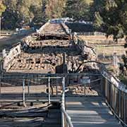
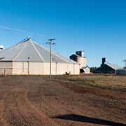
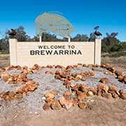
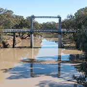
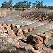
Heading northwest from Coonabarabran, the central-western plains of New South Wales are reached via the small towns of Baradine and Coonamble after 116 kilometres; another 116 kilometres further north is Walgett, near the junctions of the Barwon and Namoi Rivers. The Kamilaroi Highway, running parallel to the Barwon River, leads west to Brewarrina, 134 kilometres west of Walgett. Just before Brewarrina, the Barwon is crossed. A lift bridge, opened in 1888, reminds of the time paddle steamers were traversing the river when Brewarrina was a port for the wool trade; it was the furthest navigable point, coming from Bourke on the Darling River, 98 kilometres further west. Brewarrina is on the traditional lands of the Muruwari, Ngemba, Weilwan and Yualwarri peoples, and the riverbank was once the meeting ground for over 5,000 people. Here is Baiame’s Ngunnhu, Aboriginal fish traps in the Barwon River. It is believed that Ngemba, Wonkamurra, Wailwan and Gomolaroi people shared and maintained these traps for thousands of years. Locals claim that the traps are at least 40,000 years old, making these the oldest surviving human-made structure in the world. It all came to an end when the white settlers arrived: in 1859, between 300 and 400 Aboriginal people were slaughtered in what became known as the Hospital Creek Massacre.
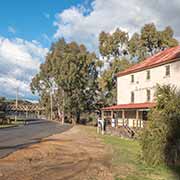
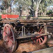
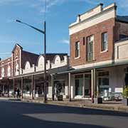
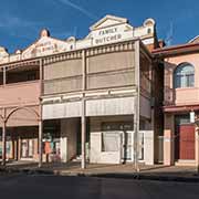
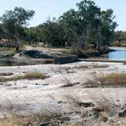
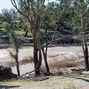
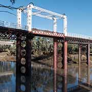
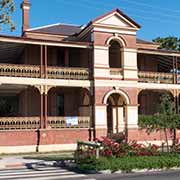
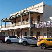
Bourke, 98 kilometres west from Brewarrina, is in the northwest of New South Wales, on a bend in the Darling River. It is the traditional country of the Ngemba people and started to be settled by whites in 1835. It became an outback trade hub, and in 1883 a lift bridge was opened in North Bourke, the oldest movable span bridge in Australia. Bourke was then the largest inland river port for paddle steamers, transporting bales of wool to the south. The Old Bourke Wharf is now rebuilt as a replica. The expression “Back O’ Bourke” refers to a remote or backward place. The Back O’ Bourke Information and Exhibition Centre is set in a native garden on the banks of the Darling River.