Photos of New South Wales - The Northeast, Australia


New South Wales - The Northeast
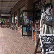
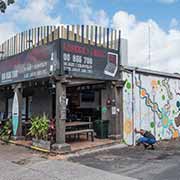
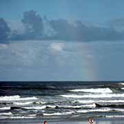
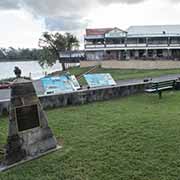
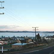
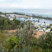
Tweeds Heads is right on the border with Queensland, adjacent to its “twin town” of Coolangatta on the Gold Coast, at the mouth of the Tweed River. Thirty kilometres inland is the town of Murwillumbah, in the hills that were home to the Kalibai people, who, as a result of white settlement, seem to have died out by the early 20th century. About 65 kilometres south of Tweed Heads is Byron Bay, a popular holiday destination, with its beaches, surfing and scuba diving sites. It is the easternmost point of mainland Australia, the traditional homeland of the Bundjalung people and now one of the most up-market residential areas on Australia’s east coast. In the sixties, it had become a favourite spot for hippies and people with an “alternative lifestyle”, and even today, there are “new age” shops and “wellness centres” in the area.
you may then send it as a postcard if you wish.
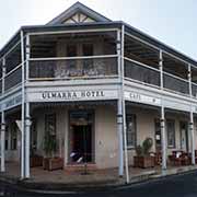
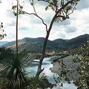
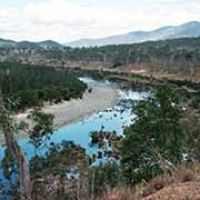
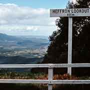
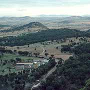

In the Northern Rivers region, Grafton is a city on the Clarence River that marked the border between the Bundjalung and Gumbaynggirr peoples. Europeans settled it to exploit the cedar trees that they discovered in the 1830s. Ulmarra, 16 kilometres north of Grafton, is a historic port on the Clarence River with well-preserved buildings. About 70 kilometres northwest of Grafton, along the Gwydyr Highway, is Gibraltar Range National park; there are scenic lookouts at Cangai Bluff and Heffron Lookout, on the way to Glen Innes. The New England Highway leads 97 kilometres south to Armidale, approximately halfway between Brisbane and Sydney.
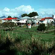
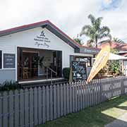
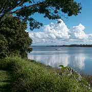
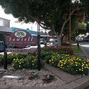
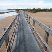
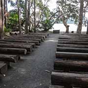
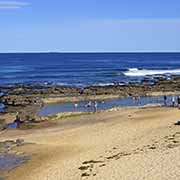
From Grafton, the Big River Highway leads 85 kilometres southeast to the city of Coffs Harbour; twelve kilometres further south is Sawtell, a pretty coastal village with great surfing beaches. About 20 kilometres further south is Urunga with its Boardwalk along the South Arm Bellinger River; it is 21 kilometres north of Nambucca Heads, in the Mid North Coast region of New South Wales. Forster, a coastal town along the Coolongolook River, is 210 kilometres south of Nambucca Heads. The Lakes Way goes south from here to Booti Booti National Park with its Green Cathedral, an outdoor church in a palm forest on the shores of Wallis Lake on the Barrington Coast.
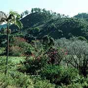
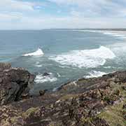
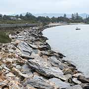
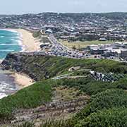
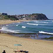
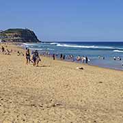
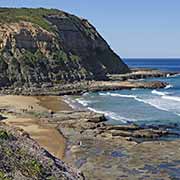
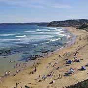
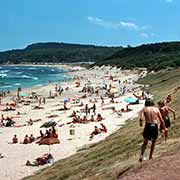
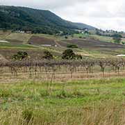
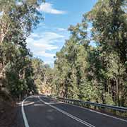
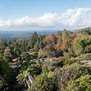
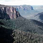
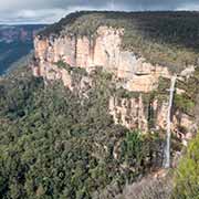
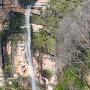
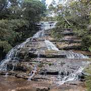
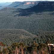
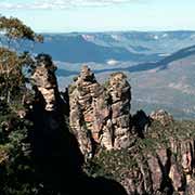
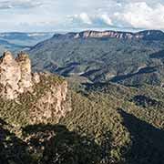
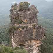
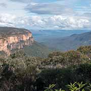
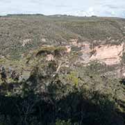
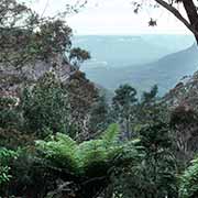
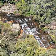
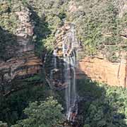
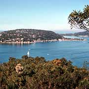
The harbour city of Newcastle, the second most populated area in New South Wales, is 162 kilometres north of Sydney. It has fantastic beaches linked by the Bathers Way, a coastal walk stretching five kilometres between Nobbys Beach and Merewether Beach in the south. Around 50 kilometres to the west in the Hunter Region are the wineries of Mount View, vineyards along Mount View Road near Cessnock. The Putty Road leads from the Hunter Region, between Yengo National Park and Wollemi National Park, to Wilberforce near the northwestern suburbs of Sydney. The Blue Mountains National Park is west of Wilberforce, a vast region, part of the Great Dividing Range. It is a stunning natural wonderland; in the northern area is the Cathedral of Ferns at Mount Wilson, a Heritage garden village, and the Blue Mountains Botanic Garden at Mount Tomah with views towards Wollemi and Yengo National Parks. In the southern area is the town of Katoomba with its beautiful views, “The Three Sisters”, the famous rock formation and the expansive views at Wentworth Falls and Govetts Leap.
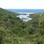
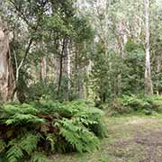
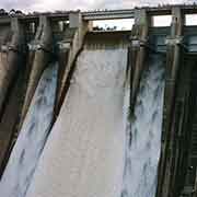
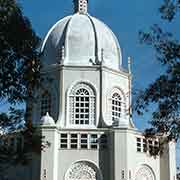
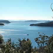
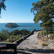
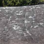
Warragamba Dam, which creates Lake Burragorang, is the primary water source for Sydney, approximately 65 kilometres to the west of the city. It is on the Warragamba River, a tributary of the Hawkesbury River. The Sydney Baháʼí House of Worship or Sydney Baháʼí Temple is situated in the northern suburb of Ingleside; it was opened in 1961 and is a prominent landmark high above Sydney’s northern beaches. Ku-ring-gai Chase National Park is a protected area just north of Ingleside, with a spectacular coastline, rainforest, bushland, and Hawkesbury River’s mouth. It has over 800 important Aboriginal sites, including ancient red ochre rock paintings and rock engravings at the Basin Trail Aboriginal Art Site, one of the best examples of petroglyphs.