Photos of Eastern Turkey, from the Black Sea to former Armenian lands, Turkey


Eastern Turkey, from the Black Sea to former Armenian lands
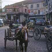
Trabzon, historically known as Trebizond on the Black Sea coast of northeastern Turkey, was a city on the Silk Road and an important trade centre between Europe and the east, the Caucasus and Persia. It was founded in 756 BCE as a Greek colony. Following the defeat of the Byzantine Empire in 1071, the city came briefly under Seljuk rule. After a period of rule by local aristocrats, it became the capital city of the Empire of Trebizond in 1204, founded following a Georgian expedition in Chaldia, in the eastern Black Sea region. The Empire of Trebizond was a successor state of the Byzantine Empire and its last independent remnant, until 1461, when it fell to Ottoman rule.
you may then send it as a postcard if you wish.
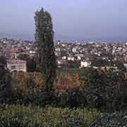
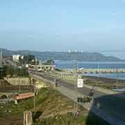
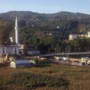
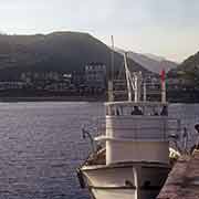
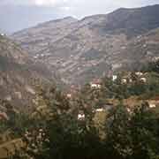

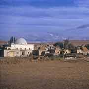
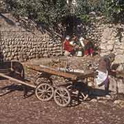
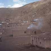
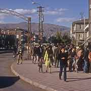


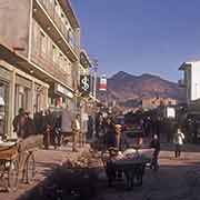

Trabzon is an important port on the Black Sea. Forty-five kilometres west, still in the District of Trabzon, is the town of Vakfıkebir, an old settlement, although its date of establishment is not known. One hundred kilometres south of Trabzon is Gümüşhane, a provincial capital at an elevation of 1,230 metres above sea level. About 130 kilometres further south is Erzincan, about 250 kilometres east of Sivas, in Central Anatolia. Sivas was founded in 64 BCE in the Roman period and was initially called Megalopolis. I changed its name to “Sebaste”, the feminine form of Augustus, in the 1st century BCE and was known as Sebasteia during the Byzantine Empire. It became the capital of Armenia Minor, Armenian–populated regions to the west and northwest of the ancient Kingdom of Armenia. This monarchy existed from 321 BCE to 428 CE and included parts of present Syria, all of eastern Turkey and present Armenia and Azerbaijan. Turkish tribes plundered and burned Sebasteia in 1059, slaughtering many. It became the Turkish “Sivas”, capital of the Seljuk Empire, but was destroyed by Tamerlane’s troops in 1400. It came under Ottoman rule in 1408.
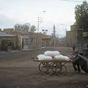
All the land east of Sivas used to have a majority Armenian population. The ancient city of Acilisene, now Erzincan, in 387 CE was the site of a treaty between the East Roman (Byzantine) Empire and the Sassanid (Persian) Empire. They divided Greater Armenia between them. The city was once named Erez, and in the recent past, it had the Armenian name of Yerznka. One hundred ninety kilometres further east is the city of Erzurum, Theodosiopolis in Roman times and Karno K’aghak’ (City of Karin) or just Karin, in Armenian. The Arab Umayyads conquered Theodosiopolis around 700, and it became the capital of an emirate. In 949 Byzantine forces recaptured it, expelled the Arabs and resettled the city with Greeks and Armenians. It came under attack by Seljuk and Georgian troops, fell to the Mongols in 1241, came under the Empire of Trebizond, the empire of Timur, the Persians and eventually the Ottomans, who conquered it in 1514.
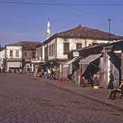
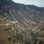
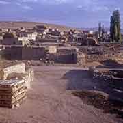
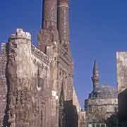
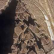
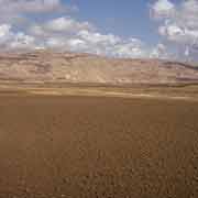
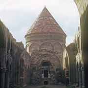
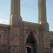
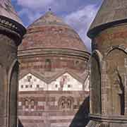
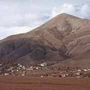
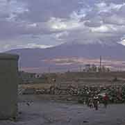
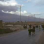
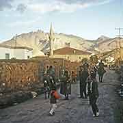
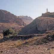
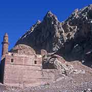
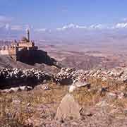
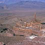
From Erzurum, it is 275 kilometres to the town of Doğubayazıt, in Ağrı Province, Turkey’s easternmost district near the borders of Armenia and Iran. Before the Ottoman Empire, the site was known by its Armenian name of Daroynk. The town is 15 kilometres southwest of Mount Ararat (in Turkish Ağrı Dağı), a dormant volcano with two peaks: Little Ararat, 3,896 metres high and Greater Ararat, with a height of 5,137 metres: Turkey’s highest peak. The Book of Genesis (8:4) refers to the mountain as the resting place of Noah’s Ark, although there is no scholarly consensus about this. Doğubayazıt has a rich history, going back to the Kingdom of Urartu, that existed over 2,700 years ago. In the 16th Century, during Ottoman rule, the town of Daroynk was renamed Beyazıt and in 1685 construction of a palace was started nearby by Colak Abdi Pasha, the bey of Beyazıt province. His son İshak Pasha continued the structure, and his grandson Mehmet Pasha completed it. An inscription on a door states that his grandson İshak (Isaac) Pasha completed the Harem Section of the palace in 1784. It is one of the few examples of surviving historical Turkish palaces and a magnificent sight.
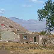
The town of Beyazıt, below the palace, was ravaged, with its Armenian population falling victim to the Armenian Genocide, perpetrated by the Ottoman army in the First World War. It was later populated by Kurds and Yazidis, a Christian ethnic Kurdish minority, but destroyed by the Turkish military in 1930 after a Kurdish uprising. The new town, Doğubayazıt (meaning “East Beyazıt”) was built about 8 kilometres to the north-west, on the plain below the old site.