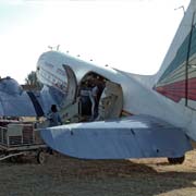
Photos of Bahir Dar, the Blue Nile and Lake Tana, Ethiopia

Bahir Dar, the Blue Nile and Lake Tana
The former province of the Gojjam region, in what is now the Amhara National Region (its flag is shown at top left), is to the northwest of Shewa (Shoa), where the capital Addis Ababa is situated. About three-quarters of its boundaries are formed by the Blue Nile river, known locally as the Abay.
you may then send it as a postcard if you wish.
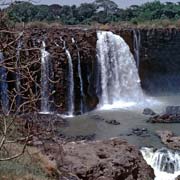
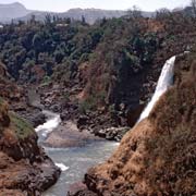
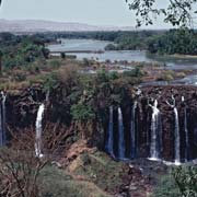
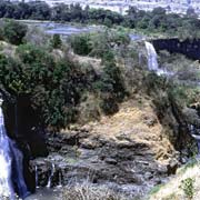
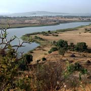
The Tis Isat (“Smoke of fire”) or Blue Nile Falls, near the town of Bahir Dar, was an impressive sight before the hydroelectric dam was built. But, in the wet season, the waters still plunge 45 metres into the gorge below and flow towards nearby Lake Tana, the highest of Africa’s lakes, measuring 68 by 73 kilometres and covering over 2,600 km². From there, the Blue Nile flows to Sudan where, at Khartoum, it joins the White Nile to form the mighty Nile flowing north towards Egypt and the Mediterranean.
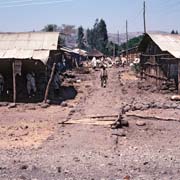
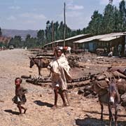
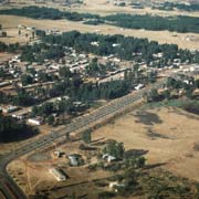
Bahir Dar is an attractive town on the southern shores of Lake Tana, about 566 kilometres from Addis Ababa or a long drive of two days. The road enters East Gojjam via a bridge over the Blue Nile Gorge; via Debre Markos and the village of Bure, it leads towards Bahir Dar, with its tree-lined avenues. The town has a population of around 130,000 and is an important commercial centre, with cotton and oil factories and educational colleges. One of Emperor Haile Selassie’s palaces stands at Bizeit, a peaceful hill overlooking the town and the Blue Nile.
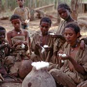
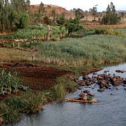
Nearby, on the southwestern shores of Lake Tana and many of the 37 islands, are churches and monasteries, many dating back to the 13th and 14th centuries; papyrus boats, called “tankwa”, can still be seen here as a means of transport.