Photos of Margaret River region, the most southwestern region of Australia


Margaret River region, the most southwestern region of Australia
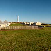
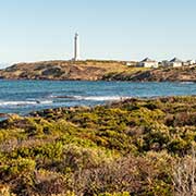
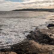
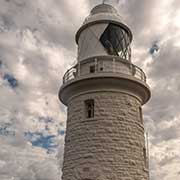
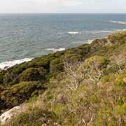
Continental Australia’s most southwesterly point is Cape Leeuwin, named by the English navigator Matthew Flinders after the first known ship to visit the area, the Dutch ship “Leeuwin” (Lioness), in 1622. There is a 39-metre-high lighthouse and a historic precinct. The 135-kilometre Cape to Cape walking track starts from here and goes to Cape Naturaliste in the north, on the ridge in Leeuwin-Naturaliste National Park.
you may then send it as a postcard if you wish.
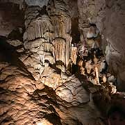
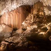
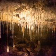
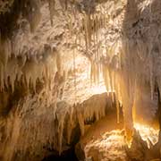
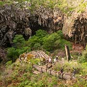
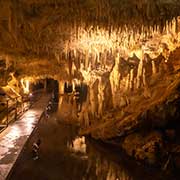
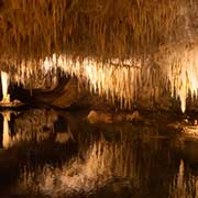
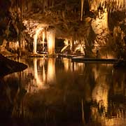
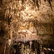
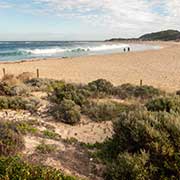
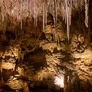
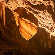
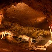
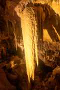
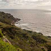
The Leeuwin-Naturaliste National Park has limestone and granite outcrops, many beaches beloved by surfers, and caves with spectacular limestone formations. The four major “show caves” in the Margaret River region are the Jewel Cave, the largest, with its long straw stalactites; Lake Cave, with a permanent lake; Mammoth Cave, where remains of megafauna, giant animals, were found; Ngilgi Cave, with “Shawls”, narrow strips of coloured calcite and the “Two Tonne Stalactite” hanging from the ceiling. All have spectacular stalactite and stalagmite formations.
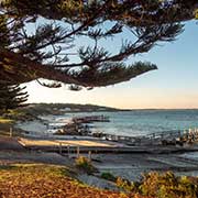
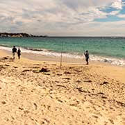
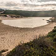
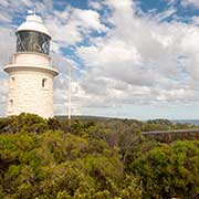
The Margaret River flows into the ocean halfway between the two capes, but it does not always reach the sea in the dry season and peters out on the beach. Cape Naturaliste also has a lighthouse at the northern end of the National Park; it was 20 metres high, was activated in 1904, and still uses its original first-order Fresnel lens. Positioned on a 100-metre-high bluff, it overlooks Geographe Bay.