Photos of the Republic of Karakalpakstan, Uzbekistan


The Republic of Karakalpakstan
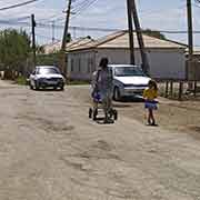
Karakalpakstan is an autonomous republic within Uzbekistan, occupying the whole northwestern end of the country. It has an area of 160,000 km² and its territory covers the classical land of Khwarezm. From about 500 BCE to 500 CE, this was a thriving agricultural area supported by extensive irrigation. The Karakalpak (Qaraqalpaq) people used to be nomadic herders and fishers and settled in the lower reaches of the Amu Darya and in the (former) delta of Amu Darya on the southern shore of the Aral Sea during the 18th century. Their name is derived from “qara”, meaning “black” and “qalpag”, “hat”, their distinguishing male headgear made from the fur of the Qaraqul breed of sheep.
you may then send it as a postcard if you wish.
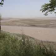
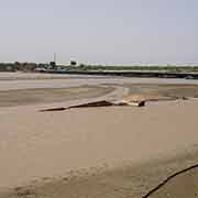
The area was ruled by the Khanate of Khiva from 1511 and ceded to the Russian Empire in 1873. The Karakalpak language belongs to the Kipchak-Nogai group of Turkic languages, which also includes Kazakh and, under Soviet rule, the territory was initially incorporated into the Kazakh SSR; only in 1936 it was transferred to the Uzbek SSR. Karakalpakstan was probably at its most prosperous in the 1960s and 1970s, when irrigation from the Amu Darya was being expanded and agriculture flourished. However, this deprived the Aral Sea of water and the drying of the once large inland sea has now rendered Karakalpakstan one of Uzbekistan's poorest regions, suffering from extensive drought. Crop failures have deprived the people of their main source of income and shortages of potable water have created a surge of infectious diseases.
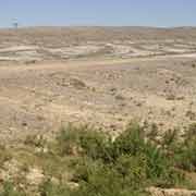
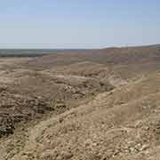
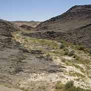
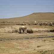
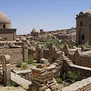
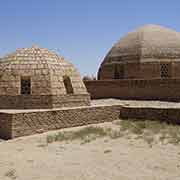
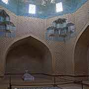
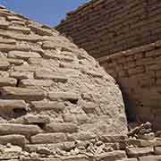
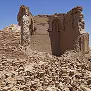
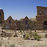
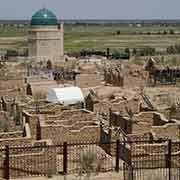
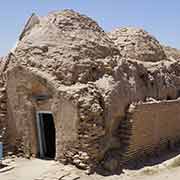
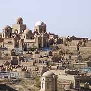
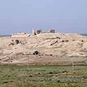
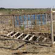
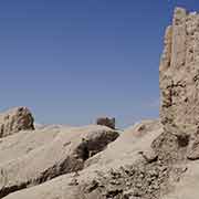
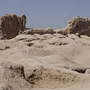
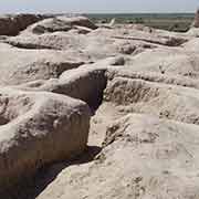
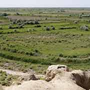
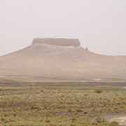
The desert landscape of Karakalpakstan can be observed from the train, linking Tashkent with the Karakalpak capital, Nukus (No’kis). About 13 kilometres west of Nukus are the well-preserved remains of ancient Mizdakhan, once the second-largest city in Khorezm with its necropolis, the ancient cemetery on a hill. Inhabited from the 4th century BCE until the 14th century CE, Mizdakhan remained a sacred place even after Timur destroyed it; tombs and mosques continued to be built here right up to the 20th century. Today it is a hill littered with those mosques and mausoleums, some ruined, some intact. Nearby is Gyaur-Qala “The Fortress of Infidels” (thus later named by Muslims, as the inhabitants were Zoroastrians), dating from the 4th to 3rd century BCE, with ten-metre walls surrounding ruins of two citadels that presumably could be a temple and palace constructions. It was destroyed by the Mongols in 1220.