Photos of The South of Mauritius, Mauritius


The South of Mauritius
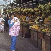
South of Port Louis are the Districts of Moka, Plaines Wilhelms and, on the coast, Rivière Noire (or Black River) and Savanne.
you may then send it as a postcard if you wish.
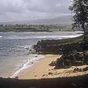
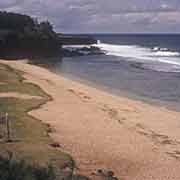
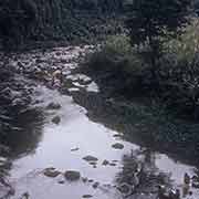
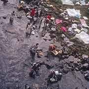
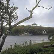
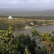
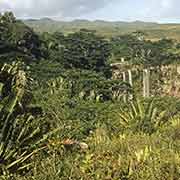
Close to the southernmost point of Mauritius is the village of Souillac, the capital of the Savanne district. It was named for the Vicomte de Souillac, the island’s governor from 1779 to 1787. He created a port here, later used by the British to ship sugar from the sugar mills to Port Louis. Souillac is on the estuary of the Savanne river, with on the opposite side the village of Surinam. Just to the east is the beach at Gris Gris, with its sea cliff. Rochester Falls, with its rectangular flank rocks, is the widest waterfall in Mauritius, about 2.5 kilometres from Souillac.
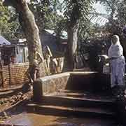
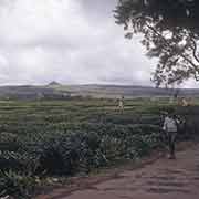
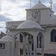
Rivière des Anguilles is a village on the river with the same name and Bois Chéri, further inland, is the biggest tea producer in Mauritius. The tea plantations here date back to 1892. Nearby is Grand Bassin, or Ganga Talao, a crater lake that has become the most important Hindu place of pilgrimage on the island. It is one of the most important Hindu pilgrimage sites outside of India. It is the seat of Shiv Mandir and the focal point of one of the island’s most important Hindu festivals, Maha Shivaratri. Its history as a pilgrimage site goes back to 1887. A “pujari” or priest from Triolet had a dream in which he saw the lake’s water springing from the river Jahnavi, another name for the goddess Ganga. In 1972, some holy water from the Ganges River was poured into it, establishing a symbolic link with the sacred Indian River; the lake was then renamed Ganga Talao.
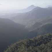
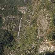
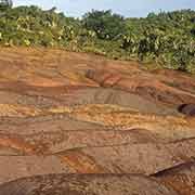
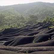
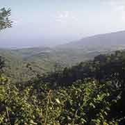
Black River Gorges National Park straddles the boundary between Savanne and Riviére Noire (Black River) Districts in the hilly south-west of Mauritius. It was proclaimed in 1994 and now protects most of the island’s remaining rainforest. To its southwest, south of Case Noyale in the Chamarel plain of the Rivière Noire District, is Terres des Sept Couleurs (Seven Coloured Earths), a geological formation. These are dunes with sand of seven distinct colours (approximately red, brown, violet, green, blue, purple and yellow). These differently coloured sands have settled in different layers, creating a unique effect.
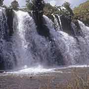
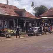
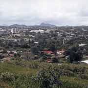
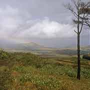
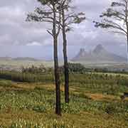
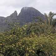
Tamarind Falls or Tamarin Falls are a series of seven cataracts located on the Rivière Tamarin, in the Plaines Williams district, 11 kilometres from Curepipe, the second city of Mauritius, with a population of around 80,000. In the town itself is Trou aux Cerfs, a dormant volcano with a well-defined cone and crater, 605 metres high and 80 meters deep. From Curepipe you can see the Three Mamelles, a mountain range in Riviére Noire district with three high peaks. Their French name comes from the resemblance of the three peaks to breasts. Just north of there is the village of Bambous, 18 kilometres south of Port Louis.