Photos of From Baucau to Lospalos, Timor-Leste


From Baucau to Lospalos
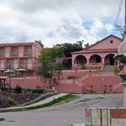
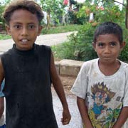
Baucau is 123 kilometres east of Dili and Timor-Leste's second-largest town, at 330 metres above sea level and with about 16,000 inhabitants. Although much of the infrastructure of the city and the surrounding area were damaged or destroyed during the riots that followed the referendum for independence in 1999, it still has many colonial Portuguese buildings, like the Pousada de Baucau (or Hotel Flamboyant, as it was called during colonial days or Hotel Baucau during Indonesian occupation), a large pink hotel, recently renovated after it was thoroughly trashed in 1999.
you may then send it as a postcard if you wish.
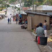
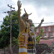

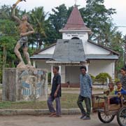
The impressive Mercado Municipal buildings of Baucau are due for renovation; meanwhile, Baucau’s market is centred alongside it on the street. The Catholic church is flanked by a pavilion, built in the style of the Fataluku people who live on the eastern side of the island.
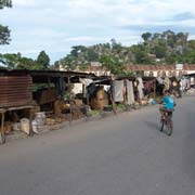
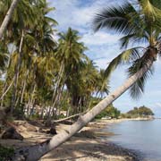
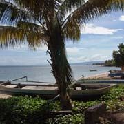
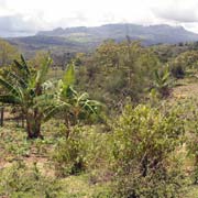
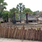
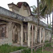
Two kilometres from old Baucau, above the cliffs that form the backdrop of the town, is Kota Baru (New Town in Indonesian). It features a market and administrative buildings (some trashed), established during the Indonesian period. Five kilometres downhill from Baucau, past rice fields and small villages, is Osolata, which used to be Baucau’s port. The old Portuguese “Alfandega” or customs house still fronts Pantai Wataboo, a beach lined with coconut palms. Osolata is now just a small village with outrigger canoes drawn up the beach.
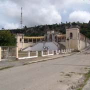
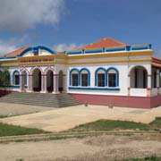
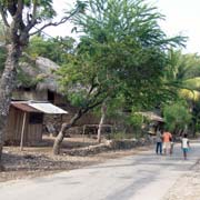
The small town of Venilale, surrounded by rice paddies, is about 28 kilometres south of Baucau, just off the road that continues to Viqueque. The most notable building is the colourful Escola do Reino de Venilale, a school that was initially built in 1933 and recently restored and freshly painted. It is now used as a library.
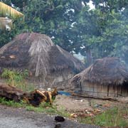
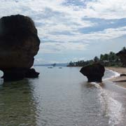
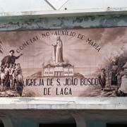
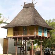
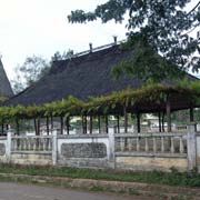
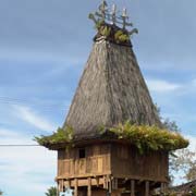
Heading east from Baucau, the road follows the coast to the village of Laga, about 19 kilometres away. It has an old Portuguese fort and the large São João Bosco church. The latter features a large ceramic panel depicting grateful Timorese introduced to Catholicism by a Portuguese friar. Next to the church is a house, built in the style of the Fataluku people who live further east. It is an elevated house with a high pitched thatched roof. 40 kilometres further on is the village of Lautém with a crumbling Portuguese fort, its walls flanking the road and Japanese bunkers still on the beach.
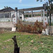
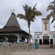
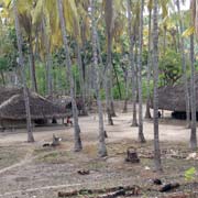
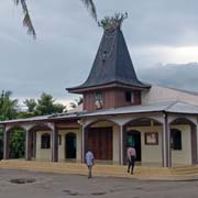
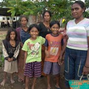
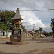
The town of Lospalos is the centre of the Fataluka people with a population of around 28,000, almost 250 kilometres east of Dili. Although the name sounds Spanish, it is derived from the Fataluku name Lohoasupala. The famous independence leader Nino Konis Santana (1959-1998) was born here. The town suffered a lot of damage from Indonesian militia after the independence vote in 1999, and many buildings along the main road are still in ruins. A replica Fataluku house with its pitched roof and roof decoration was built in 1990 next to the market. A Fataluku house roof also tops the Catholic church.