The North-central districts of Suriname

Brokopondo Reservoir

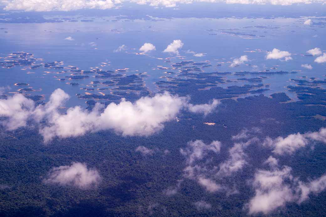
The Brokopondo Reservoir, officially named Professor Doctor Ingenieur W. J. van Blommestein Meer, with a surface area of approximately 1,560 km², depending on the current water level, one of the largest reservoirs in the world, flooding nearly one percent of the country. It was created by constructing Afobaka Dam across the Suriname River, about 110 kilometres south of Paramaribo, between 1961 and 1964.

Photo by Ludo Kuipers, Fri Jan 15, 2016
Back
To send this Photo as a Postcard:
Click or tap here:
Postcard
Postcard
 
To send this photo as a Postcard, fill in the boxes:
Brokopondo Reservoir Your name:
Your e-mail address:
Who to send it to?
Their e-mail address:
Type a Heading;
their name appears here:

(you may type over this)
Type your Message here:
Sign your card;
your name appears here:

(you may type over this)
Preview your Postcard, Start again or Cancel:
CANCEL

To send this photo as a Postcard, fill in the boxes below:

Brokopondo Reservoir What is your name?
What is your e-mail address?
Who you want to send it to?
What is their e-mail address?
Type a Heading (Their name automatically appears here):
(you may type over this)
Type your Message here:
Sign your Postcard: (Your name automatically appears here)
(you may type over this)
Preview your Postcard, Start again or Cancel:
CANCEL