Uluru-Kata Tjuta National Park, Central Australia

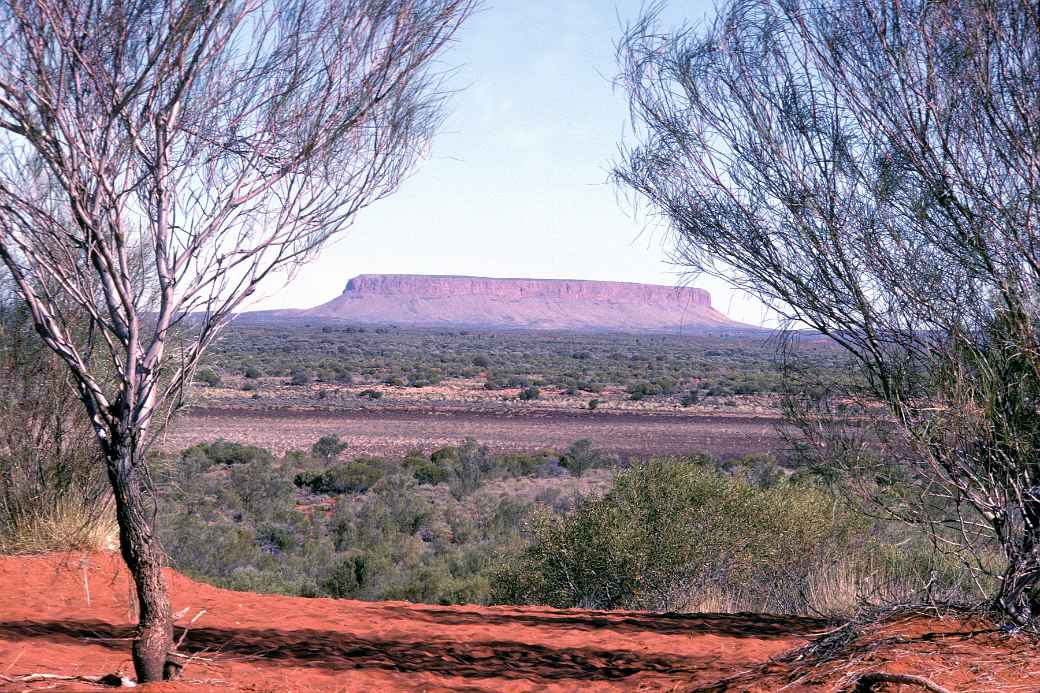
Atila - Mt. Conner

Atila, or Mt. Conner, a significant sacred site about 100 kilometres east of Uluru (Ayers Rock) in the southwest of the Northern Territory, visible from the road and often mistaken for Ayers Rock by visitors. It is about the same height: 859 metres above sea level.

Photo by Ludo Kuipers, Mon Jul 15, 1991
Back
To send this Photo as a Postcard:
Click or tap here:
Postcard
Postcard
 
To send this photo as a Postcard, fill in the boxes:
Atila - Mt. Conner Your name:
Your e-mail address:
Who to send it to?
Their e-mail address:
Type a Heading;
their name appears here:

(you may type over this)
Type your Message here:
Sign your card;
your name appears here:

(you may type over this)
Preview your Postcard, Start again or Cancel:
CANCEL

To send this photo as a Postcard, fill in the boxes below:

Atila - Mt. Conner What is your name?
What is your e-mail address?
Who you want to send it to?
What is their e-mail address?
Type a Heading (Their name automatically appears here):
(you may type over this)
Type your Message here:
Sign your Postcard: (Your name automatically appears here)
(you may type over this)
Preview your Postcard, Start again or Cancel:
CANCEL